Bestaand:Finland location map.svg

Afmetingen van deze voorvertoning van het type PNG van dit SVG-bestand: 304 × 599 bealdpunten Andere resolutys: 122 × 240 bealdpunten | 243 × 480 bealdpunten | 390 × 768 bealdpunten | 520 × 1.024 bealdpunten | 1.039 × 2.048 bealdpunten | 872 × 1.718 bealdpunten.
Oorsprungelik bestand (SVG-bestand, uutgangsgroutde 872 × 1.718 bealdpunten, bestandsgroutde: 1,1 MB)
Beskryving
| Beskryving |
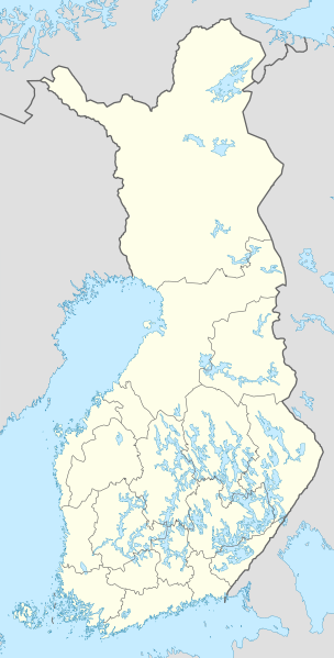
Deutsch: Positionskarte von Finnland
Quadratische Plattkarte, N-S-Streckung 235 %. Geographische Begrenzung der Karte:
English: Location map of Finland
Equirectangular projection, N/S stretching 235 %. Geographic limits of the map:
|
| Dåtum | |
| Bron | own work, using United States National Imagery and Mapping Agency data |
| Autöör | NordNordWest |

|
Deze kaart is gemaakt of verbeterd in de Duitse Kartenwerkstatt (Map Lab). Je kunt ook zelf kaarten ter verbetering voorstellen.
|
Licensy
Ik, de autöörsrechtholder van dit wark, geave disse media uut under de volgende licensy:

|
Der wördt tostemming geaven vöär et kopieren, verspreiden en/of wysigen van dit dokument under de vöärwaerden van de GNU-licensy vöär vrye dokumentaty, versy 1.2 of een latere versy so as uutgeaven döär de Free Software Foundation; sunder unveranderlike sektys, sunder ümslagteksten vöär of achter. Een kopy van de licensy is upnöämen in de sekty GNU-licensy vöär vrye dokumentaty. |
Dit bestand valt under de Creative Commons-licensy Naamsvermelding-Lyke deylen 3.0 neet porteerd
- Jy möäget:
- üm te deylen – et wark kopieren, verspreiden en döärgeaven
- üm te hermengen – et wark anpassen
- Under de volgende vöärwaerden:
- naamsvermelding – Jy müttet up en nette manere an naamsvermelding doon, en verwysing nå de licensy geaven en angeaven of der anpassingen dån bint. Jy möäget dit up elke readelike manere doon, mär neet up sou'n manere dat et de indrük wekt dat de lincensyholder juw wark understöänt of juw gebruuk van syn wark.
- lyke deylen – As jy materiaal menget, veranderet, of derup voordbouwet, dan müt jy juw bydragen verspreiden under deselvde of een vergelykbåre licensy as de oorsprungelike.
Jy möäget selv eyn van de licensys kesen.
Bestandsgeskydenisse
Klik up een datum/tyd üm et bestand te seen so as et destyds was.
| Datum/tyd | Miniatuurafbealding | Groutde | Gebruker | Kommentaar | |
|---|---|---|---|---|---|
| aktueel | 14:06, 26 jan 2021 | | 872 × 1.718 (1,1 MB) | Fenn-O-maniC | Updated regional borders as per https://asiointi.maanmittauslaitos.fi/karttapaikka/ |
| 12:50, 9 mrt 2011 |  | 872 × 1.718 (1,07 MB) | NordNordWest | upd | |
| 22:41, 20 jan 2010 |  | 872 × 1.536 (1,2 MB) | NordNordWest | update | |
| 20:12, 5 aug 2008 |  | 873 × 1.536 (1,07 MB) | NordNordWest | ||
| 13:54, 30 jul 2008 |  | 873 × 1.536 (1,01 MB) | NordNordWest | optimized | |
| 20:55, 8 jul 2008 |  | 873 × 1.536 (1,33 MB) | NordNordWest | ||
| 16:05, 7 jul 2008 |  | 873 × 1.536 (1,28 MB) | NordNordWest | ||
| 21:31, 30 jun 2008 |  | 873 × 1.536 (1,38 MB) | NordNordWest | ||
| 22:35, 29 jun 2008 |  | 873 × 1.536 (1,38 MB) | NordNordWest | {{Information |Description= {{de|Positionskarte von Finnland}} Quadratische Plattkarte, N-S-Streckung 210 %. Geographische Begrenzung der Karte: * N: 70.4° N * S: 59.5° N * W: 19° W * O: 32° W {{en|Location map of [[:en:Finland|Finlan |
Bestandsgebruuk
Dit bestand wördt up de volgende syde gebruked:
Globaal bestandsgebruuk
De volgende andere wikis gebruken dit bestand:
- Gebruuk up am.wikipedia.org
- Gebruuk up an.wikipedia.org
- Gebruuk up arz.wikipedia.org
- Gebruuk up av.wikipedia.org
- Gebruuk up bg.wikipedia.org
- Gebruuk up bs.wikipedia.org
- Gebruuk up ca.wikipedia.org
- Gebruuk up ceb.wikipedia.org
Globaal gebruuk van dit bestand bekyken.