Bestaand:Relief Map of Bulgaria.jpg

Groutde van disse weadergåve: 800 × 505 bealdpunten. Andere resolutys: 320 × 202 bealdpunten | 640 × 404 bealdpunten | 1.024 × 646 bealdpunten | 1.280 × 808 bealdpunten | 1.642 × 1.036 bealdpunten.
Oorsprungelik bestand (1.642 × 1.036 bealdpunten, bestandsgroutde: 459 kB, MIME-type: image/jpeg)
Beskryving
| Beskryving |
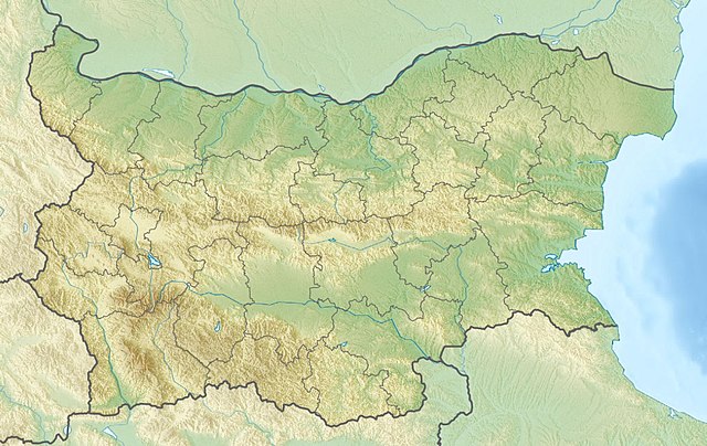
English: Location map of Bulgaria Equirectangular projection, N/S stretching 130 %. Geographic limits of the map:
|
| Dåtum | (UTC) |
| Bron |
|
| Autöör |
|
| Aandere versies | Derivative works of this file: Relief Map of Bulgaria Burgasebene.jpg |
| Dit is een geretoucheerde foto, wat betekent dat de originele versie digitaal aangepast is. Het origineel kan hier bekeken worden: Bulgaria location map.svg.
|
Licensy
Ik, de autöörsrechtholder van dit wark, geave disse media uut under de volgende licensy:
Dit bestand valt under de Creative Commons-licensy Naamsvermelding-Lyke deylen 3.0 neet porteerd
- Jy möäget:
- üm te deylen – et wark kopieren, verspreiden en döärgeaven
- üm te hermengen – et wark anpassen
- Under de volgende vöärwaerden:
- naamsvermelding – Jy müttet up en nette manere an naamsvermelding doon, en verwysing nå de licensy geaven en angeaven of der anpassingen dån bint. Jy möäget dit up elke readelike manere doon, mär neet up sou'n manere dat et de indrük wekt dat de lincensyholder juw wark understöänt of juw gebruuk van syn wark.
- lyke deylen – As jy materiaal menget, veranderet, of derup voordbouwet, dan müt jy juw bydragen verspreiden under deselvde of een vergelykbåre licensy as de oorsprungelike.

|
Der wördt tostemming geaven vöär et kopieren, verspreiden en/of wysigen van dit dokument under de vöärwaerden van de GNU-licensy vöär vrye dokumentaty, versy 1.2 of een latere versy so as uutgeaven döär de Free Software Foundation; sunder unveranderlike sektys, sunder ümslagteksten vöär of achter. Een kopy van de licensy is upnöämen in de sekty GNU-licensy vöär vrye dokumentaty. |
Jy möäget selv eyn van de licensys kesen.
Oorspronkelik logboek mit nieje bestaanden
This image is a derivative work of the following images:
- File:Bulgaria_location_map.svg licensed with Cc-by-sa-3.0, GFDL
- 2010-10-06T18:28:14Z NordNordWest 1642x1036 (282074 Bytes) upd
- 2009-08-12T18:23:52Z Пакко 1536x970 (209136 Bytes) fixed Iskar Lake
- 2009-08-03T18:12:56Z Пакко 1534x967 (211583 Bytes) fixed some borders according to current administrative division
- 2008-08-25T18:52:33Z NordNordWest 1645x1038 (304442 Bytes) size correction
- 2008-08-12T12:25:58Z NordNordWest 548x346 (298143 Bytes) corrected
- 2008-08-05T20:30:09Z NordNordWest 548x346 (296113 Bytes) {{Information |Description= {{de|Positionskarte von [[:de:Bulgarien|Bulgarien]]}} Quadratische Plattkarte, N-S-Streckung 130 %. Geographische Begrenzung der Karte: * N: 44.4° N * S: 41.1° N * W: 22.1° O * O: 28.9° O {{en|
Uploaded with derivativeFX
Bestandsgeskydenisse
Klik up een datum/tyd üm et bestand te seen so as et destyds was.
| Datum/tyd | Miniatuurafbealding | Groutde | Gebruker | Kommentaar | |
|---|---|---|---|---|---|
| aktueel | 11:20, 3 apr 2016 | | 1.642 × 1.036 (459 kB) | Pticy uleteli | унификация разрешения с административной картой для корректной работы imagemap |
| 12:26, 28 nov 2010 |  | 1.200 × 757 (306 kB) | Виктор В | {{Information |Description={{en|Location map of Bulgaria}} Equirectangular projection, N/S stretching 130 %. Geographic limits of the map: * N: 44.4° N * S: 41.1° N * W: 22.1° E * E: 28.9° E |Source=*[[:File:Bulgaria_location_map. |
Bestandsgebruuk
Dit bestand wördt up de volgende syde gebruked:
Globaal bestandsgebruuk
De volgende andere wikis gebruken dit bestand:
- Gebruuk up am.wikipedia.org
- Gebruuk up ar.wikipedia.org
- Gebruuk up ast.wikipedia.org
- Gebruuk up azb.wikipedia.org
- Gebruuk up az.wikipedia.org
- Şablon:Yer xəritəsi Bolqarıstan
- Pirin Milli Parkı
- Rodop dağları
- Srebırna Təbiət Qoruğu
- Maqura mağarası
- Pirin
- Belintaş
- Balkan dağları
- Mərkəzi Balkan Milli Parkı
- Əminə burnu
- Kom dağı
- Stara-Reka qoruğu
- Bayuvi-Dupki — Cincirsa
- Uzunbucaq
- Yulen qoruğu
- Orelyak qoruğu
- Sıyeva dupka
- Buynovsk dərəsi
- Uxlovitsa mağarası
- Triqrad dərəsi
- Kamçiya qoruğu
- Ali Botuş qoruğu
- Pobiti daşları
- Torfeno Branişte
- Bistrişko Branişte
- Poda Qorunan Təbiət Ərazisi
- Beloslav gölü
- Proxodna mağarası
- Rozhen Rəsədxanası
- Gebruuk up ban.wikipedia.org
- Gebruuk up ba.wikipedia.org
- Gebruuk up be.wikipedia.org
Globaal gebruuk van dit bestand bekyken.